Boulder's Main Peak Series: Mount Sanitas
There are many ways to navigate to the top of this mountain. It tops out at 6,863ft, and is the smallest of all of Boulder's major summits. However it is doesn't have to be a walk in the park, and their are many ways to make this hike harder if that's what you're looking for. It is actually quite common for runners and hikers to do "laps" of this mountain. Sanitas is the most accessible peak year round for hikers that might not be as big of a fan of the ice and snow. When I run or hike Sanitas, I personally often find myself joking that its Mount SINitas or Mount SUNitas. Or both in the summer time.
Tips for Parking:
There are several different lots to park from. Outside of the abbreviated Lion's Lair and the Goat trail, most can start at either Sanitas Trailhead or Centennial Trailhead which are approximately 0.20 miles apart. Sanitas Trailhead is limited to only a handful of cars, but Centennial will have more parking availability. If you are hiking this during a busy time, there is also the option to park on the side street of Mapleton and on 4th street. Street parking is free and there is no time limit.
1.) Sanitas Valley
Starting from the bottom of Sanitas Valley trail you'll climb up for about 1.2 miles and veer left to continue to the Est Ridge Trail. This trail will get slightly more technical than the Sanitas Valley trail, but it is only 0.6 miles until you reach the top of Mount Sanitas. From the top you will ascend down the East Ridge Trail and take a right back down Sanitas Valley trail to finish.
Parking: Sanitas Trailhead OR Centennial Trailhead
Total Distance: 3.6 miles
Elevation Gain:12,94ft
Approximate Time: 60-90 minutes
2.) Mount Sanitas Trail Out and Back
This is the most direct route to the top. It is 1.14 miles from the trailhead to the top. At the trailhead mapping post you'll take a slight left onto Mt Sanitas trail which you will follow the whole way. No switch backs, just a lot of rocks and steps to the top of a great view of Boulder.
Parking: Sanitas Trailhead OR Centennial Trailhead
Total Distance: 2.6 miles
Elevation Gain: 1,295ft
Approximate Time: 40-70 minutes
3.) Mount Sanitas/ Sanitas Valley Loop
To make this loop you can either go clockwise for 1.15 miles up Mt Sanitas Trail, down Est Ridge Trail for about 0.6 miles and then taking a right down Sanitas Valley Trail. Or you can choose to go counter-clockwise going up Sanitas Valley Trail for 1.26 miles, taking a left up Est Ridge trail for about 0.6 miles and descending Mt Sanitas Trail. Mt Sanitas trail is slightly more technical with larger steps, so keep that in mind when choosing your direction.Parking: Sanitas Trailhead OR Centennial TrailheadTotal Distance: 3.1 milesElevation Gain: 1,294ftApproximate Time: 60-90 minutes
4.) Lion's Lair Out and Back
Regardless of where you park, you will still need to start at the Centennial Trailhead. You'll go up a short incline and turn right to follow along Sunshine Canyon trail for about 1.2 miles. This trail hugs Sunshine Canyon Road, so if you cannot see the road you're probably not on the right trail. At the end of the trail it will take a slight bend to the right, you will cross the road and there will be a green sign to lead you onto the correct path. This is the beginning of the Lion's Lair trail . You will climb up a set of stairs but the rest of the way the trail is a mellow climb with many switchbacks to the top. The is the least technical route up to Mount Sanitas. The only part that may confuse some is seeing a sign for Lion's Lair Spur. Do not go onto the Lion's Lair Spur trail, as it will take you down to Sunshine Canyon road to a parking spot.Parking: Centennial Trailhead or Sanitas TrailheadTotal Distance: 7.5 milesElevation Gain: 1,323ftApproximate Time: 90 minutes to 2 hours
5.) Abbreviated Lion's Lair Out and Back
This is a great option for those looking to do a shorter hike to the top without a technical route and extreme steepness. I find this is the most family friendly of all the routes (unless your kids are really good with safely scrambling lots of rocks!)
You will start on Lion's Lair Spur which will connect you to the main Lion's Lair trail. You'll take a left onto the trail and follow it to the top.
Total Distance: 4.18 milesElevation Gain: 755ftApproximate Time: 60-90 minutes
6.)Lion's Lair Up, Down Sanitas Valley or Mount Sanitas
Starting from Centennial Trailhead you'll go up a short incline and turn right to follow along Sunshine Canyon trail for about 1.2 miles. At the end of the trail it will take a slight bend to the right, you will cross the road and climb up the stairs. This is the beginning of the Lion's Lair trail and there will be a green sign to lead you onto the correct path. The trail switchbacks several times and is a fairly mellow climb. The is the least technical route up to Mount Sanitas. The only part that may confuse some, is do not go onto the Lion's Lair Spur trail. That will only take you down to Sunshine Canyon road to a parking spot. Once at the top of Mount Sanitas you have a few options. One is to make a loop down Mt Sanitas Trail, the most direct way and the steepest. You can also make a loop by follow the green signs at the top pointing you to the Est Ridge Trail. You can take this down and turn right down Sanitas Valley to loop back to the parking lot. There is also the option to do these loops in reverse. Going up the steeper more technical route and descending a mellow climb. So many ways to adventure!
Parking: Centennial Trailhead or Sanitas Trailhead (limited parking)Total Distance: 4.95 miles (Sanitas Valley descent: 5.62 miles)Elevation Gain: 1,310ft (Sanitas Valley descent: 13,36ft)Approximate Time: 90 minutes - 2 hours
7.) The Goat Trail Start
Starting on The Goat trail you'll follow the switch backs up to the top of the Sanitas Valley trail. Take a slight right going upwards on to the East Ridge Trail. Follow this trail to the top.
Parking on the street is allowed. You can park at any open spot on 4th street, Hawthorn Ave or Forest Ave. There are a few different starting points around this area but all connect to the goat trail shortly after.
Parking: Start HERE
Total Distance: 2.66 miles RT
Elevation Gain: 1,293ft
Approximate Time: 50-75 minutes
 | ||||
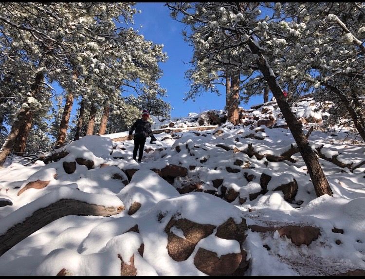
| This is a photo of the summit. Photo Credit to the business, In Motion Running, a running shoe store in boulder that I highly recommend. 
|


Comments
Post a Comment